Ma'an
Ma'an (مَعان) is a city in southern Jordan, 218 km southwest of the capital Amman. It serves as the capital of the Ma'an Governorate. Its population was approximately 41,055 in 2015. Civilizations with the name of Ma'an have existed at least since the Nabatean period—the modern city is just northwest of the ancient town. The city is an important transport hub situated on the ancient King's Highway and also on the modern Desert Highway.
Ma'an was founded by the Minaeans (known as "Ma'in" in Arabic), an ancient Arab people based in Yemen, between the 2nd and 4th century BCE. The site was located on a major trade route and was settled by Minaean traders and merchants. Local tradition has it that the city was named after "Ma'an", the son of Lot.
During the Byzantine era in Syria, Ma'an was part of the territory of the Arab Christian tribe of Banu Judham who served as vassals for the Byzantines in Transjordan. In the early 7th century, the Christian governor of Ma'an, Farwa ibn Amr al-Judhami, converted to Islam and sent Muhammad a wide array of presents including a white mule and gold. When the Byzantine authorities learned of his conversion he was ordered to repent his new religion, but refused. Consequently, the Byzantine emperor ordered his imprisonment and subsequent execution by crucifixion. In retaliation the Muslim state in Medina, sent an army led by Usama ibn Zayd to conquer Ma'an.
Map - Ma'an
Map
Country - Jordan
 |
 |
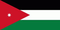
| Flag of Jordan | |
Modern-day Jordan has been inhabited by humans since the Paleolithic period. Three stable kingdoms emerged there at the end of the Bronze Age: Ammon, Moab and Edom. In the third century BC, the Arab Nabataeans established their Kingdom with Petra as the capital. Later rulers of the Transjordan region include the Assyrian, Babylonian, Roman, Byzantine, Rashidun, Umayyad, Abbasid, and the Ottoman empires. After the Great Arab Revolt against the Ottomans in 1916 during World War I, the Greater Syria region was partitioned by Britain and France. The Emirate of Transjordan was established in 1921 by the Hashemite, then Emir, Abdullah I, and the emirate became a British protectorate. In 1946, Jordan gained independence and became officially known in Arabic as the Hashemite Kingdom of Jordan. The country captured the West Bank during the 1948 Arab–Israeli War and annexed it until it was lost to Israel in 1967. Jordan renounced its claim to the territory in 1988, and became the second Arab state to sign a peace treaty with Israel in 1994.
Currency / Language
| ISO | Currency | Symbol | Significant figures |
|---|---|---|---|
| JOD | Jordanian dinar | دا | 3 |
| ISO | Language |
|---|---|
| AR | Arabic language |
| EN | English language |


